

Residents of Vero Beach and the wider Treasure Coast should prepare for a wet and windy week as a cold front settles across Central Florida. According to the National Weather Service in Melbourne, this weather pattern is delivering steady rain to the region, alongside coastal hazards and a noticeable drop in temperatures.
Forecasts indicate consistent precipitation for the area, with Vero Beach and Fort Pierce experiencing an initial 60 percent chance of rain, followed closely by Stuart at 50 percent.
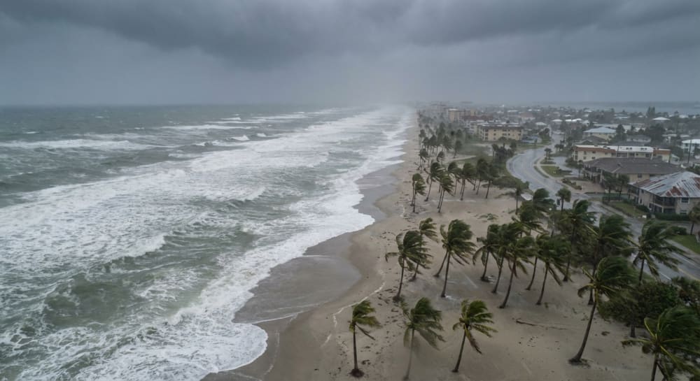
A total of 2 to 4 inches of rain is expected to fall across the Treasure Coast through April 9, with localized higher amounts possible and isolated flash flooding risks near the immediate coast.
Meteorologist Melissa Watson noted that showers will remain light to moderate on and off throughout the week, extending into April 10. While the rain brings gloomy skies, it offers significant relief to local drought conditions. The Florida Forest Service measures soil dryness using the Keetch-Byram drought index on a scale of 0 to 800. Prior to the storms, Indian River County registered at an elevated 500. Neighboring Martin County registered at 550, while St. Lucie County showed slight improvement at 450.
Along with the rain, local residents and visitors must be vigilant regarding marine hazards. The National Weather Service has issued strong advisories for beachgoers and boaters:
- Dangerous Boating Conditions: Rough, high waves and a surge of northeast winds are expected to create hazardous waters.
- High Winds: There is a low to medium chance of wind gusts reaching 35 to 45 mph from April 8 through April 10.
- Rip Currents and Surf: A high risk of rip currents persists across all local beaches, with dangerous surf conditions expected mid-week. Meteorologists strongly advise staying out of the ocean.
Temperatures across the Treasure Coast are expected to temporarily drop from the low and mid-80s down to the mid- and upper 70s for most of the week. Warmer weather will return by the weekend as temperatures climb back into the low 80s and rain chances decrease to 30 percent or below.


