

Residents across Vero Beach and the wider Treasure Coast can expect a significant shift in weather patterns this weekend. A passing cold front is forecasted to bring much-needed rain and gusty winds to the region, though meteorologists warn it will not be enough to break the area’s ongoing moderate to extreme drought conditions.
The transition begins after a stretch of unseasonably warm weather. Temperatures were predicted to reach the low 80s along the coast and climb into the mid-to-upper 80s further inland. Skies during this initial period will remain partly cloudy with light, variable winds moving onshore during the afternoon, bringing only a slight chance of late-day inland showers.
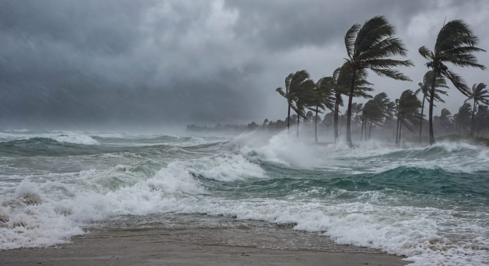
However, the mild conditions will quickly deteriorate as the cold front advances. Tracking southward from the Volusia County coast, the system will introduce sweeping changes to the local environment. The National Weather Service in Melbourne predicts this front will generate peak wind gusts between 30 and 45 mph, heavily impacting coastal communities.
In addition to developing rain showers, the front will create highly dangerous ocean conditions. Beachgoers and boaters are advised to exercise extreme caution. Navigational and recreational hazards include high surf, rough seas, gale-force winds, and numerous strong rip currents along all Treasure Coast beaches.
While the incoming precipitation is a welcome sight for East Central Florida, long-term rainfall deficits remain a critical concern. Recent mid-March showers brought near-to-above-normal rainfall to some isolated areas, but the broader region is still severely lacking in moisture. The National Weather Service has highlighted significant local deficits extending back to November 1:
- Vero Beach: Only 5.65 inches of rainfall has been recorded, leaving the city 7.45 inches below its normal average.
- Fort Pierce: The situation is similarly dry, with just 4.94 inches of rainfall recorded during the same period, marking a deficit of 7.59 inches.
To monitor these conditions, the Florida Forest Service utilizes the Keetch-Byram drought index to measure the dryness of soil and duff layers. This scale ranges from 0 to 800, with 800 representing the absolute driest conditions. The index naturally increases on dry days and decreases following rain events.
Current local drought metrics reflect the ongoing deficits. Indian River County has seen some recent improvement, bringing its index down to a moderate 450. However, neighboring areas remain significantly drier, with St. Lucie County registering an index of 500 and Martin County experiencing elevated drought levels at 600.
While a passing cold front will deliver scattered rain showers and coastal wind gusts up to 45 mph across the Treasure Coast, significant long-term precipitation deficits in Vero Beach and Fort Pierce mean that the region’s moderate to extreme drought conditions will persist.


